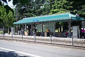
East 162nd Avenue station
Appearance
| MAX Light Rail station | |||||||||||
 | |||||||||||
| General information | |||||||||||
| Location | E Burnside & 162nd Avenue Portland/Gresham, Oregon USA | ||||||||||
| Coordinates | 45°31′20″N 122°29′47″W / 45.522171°N 122.496451°W | ||||||||||
| Owned by | TriMet | ||||||||||
| Platforms | 2 side platforms | ||||||||||
| Tracks | 2 | ||||||||||
| Connections | |||||||||||
| Construction | |||||||||||
| Bicycle facilities | bike racks | ||||||||||
| Accessible | Yes | ||||||||||
| History | |||||||||||
| Opened | September 5, 1986 | ||||||||||
| Services | |||||||||||
| |||||||||||
| |||||||||||
East 162nd Avenue station is a MAX light rail station on the boundary between Portland and Gresham in Oregon, USA. It serves the Blue Line and is the 18th stop eastbound on the current Eastside MAX branch.
The station is at the intersection of East Burnside Street and NE/SE 162nd Avenue. It has staggered side platforms, which sit on either side of the cross street. Trains operate in the median of Burnside Street and the two platforms are located immediately after a train crosses 162nd Avenue, in both directions.
Bus line connections
[edit]Since March 2018, the station has been served by the 74 bus line to 74 - 162nd Ave, which was newly introduced at that time.[1]
References
[edit]- ^ Murphy, Angela (March 5, 2018). "TriMet rolls new bus lines into service with dual early morning ribbon-cuttings" (Press release). TriMet. Archived from the original on March 19, 2018. Retrieved March 9, 2018.
External links
[edit]- Station information (with eastbound ID number) from TriMet
- Station information (with westbound ID number) from TriMet
- MAX Light Rail Stations – more general TriMet page
Categories:
- MAX Light Rail stations
- MAX Blue Line
- Buildings and structures in Gresham, Oregon
- 1986 establishments in Oregon
- Railway stations in the United States opened in 1986
- Railway stations in Multnomah County, Oregon
- United States light rail stubs
- Western United States railway station stubs
- Oregon building and structure stubs
- Oregon transportation stubs

