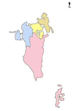
Capital Governorate, Bahrain
Capital Governorate
محافظة العاصمة Muḥāfaẓat al-ʿĀṣimah | |
|---|---|
Governorate | |
 Map of Bahrain showing Capital Governorate | |
| Country | |
| Government | |
| • Governor | Rashid bin Abdulrahman Al Khalifa |
| Area | |
| • Land | 78.71 km2 (30.39 sq mi) |
| Population (2020 Census)[1] | |
| • Total | 548,345 |
| Time zone | UTC+3 (Arabia Standard Time) |
| Website | www.capital.gov.bh |
 |
|---|
|
|
| Judiciary |
| Administrative divisions (governorates) |
|
|

The Capital Governorate (Arabic: محافظة العاصمة, romanized: Muḥāfaẓat al-ʿĀṣimah) is one of the four governorates of Bahrain. The governorate includes Manama, the capital of Bahrain. It is the most populous administrative region in the country, with a population of over half million people in 2020.
Formation
[edit]The Capital Governorate was formed by royal decree on 3 July 2002. The present governorate incorporates the municipalities of Al Manamah, Jid Ali, Ras Rumman and parts of Jidd Haffs.[2]
Demographics
[edit]According to a census conducted in 2010, there are 329,510 people living in the Capital Governorate, which is the highest of the four governorates; 261,921 non-Bahraini citizens and 67,589 Bahraini nationals.[3] The vast majority of housing in the Capital Governorate are flats, with around 34,000 flats.[4] Private villas were the second most-common form of housing, accounting for 7,284 of housing in the governorate.[4]
As at the 2020 Census, the governorate's total population stands at 548,345 people in a land area of 78.71 km2, with a population density of 6,967 per km2.[1]
References
[edit]- ^ a b "Annual Report 2020" (PDF). Capital Governorate. Retrieved 14 July 2021.
- ^ "Decree Law No. (17) of 2002" (PDF). Capital Governorate. Retrieved 10 August 2012.
- ^ "Population by Governorate" (PDF). Census 2010. Archived from the original (PDF) on 2013-10-25. Retrieved 10 August 2012.
- ^ a b "Census results". Census2010. Archived from the original on 2012-03-20. Retrieved 10 August 2012.
26°14′10″N 50°34′59″E / 26.23611°N 50.58306°E

